Trails that lead to Minneapolis

IMG 421t edited 1 w
Mississippi River – 3rd avenue bridge

It is a little over 10 miles by bike from the downtown St. Paul area to the St. Anthony falls area in Minneapolis.  There is a bike path along the river but I rode on Summit avenue and cut over to Marshal and crossed the Mississippi on the Lake Street bridge.  I took this picture from Father Hennepin Park.  

Sometimes people who live in St. Paul can’t find Minneapolis.  They should try harder. 

Art from dusk until dawn

lighbulbs upperlanding

I was wondering what was up with the wires and poles that have been in the Upper Landing Park for a the last couple of weeks.  When I was walking my dog the other night they were hanging light bulbs on the wires.   The lights are part of Northern Spark Nuit Blanche (White night festival) an art event that begins at dusk today June 4th and goes until dawn tomorrow June 5th. 

“Northern Spark will include a diversity of art forms and projects including multi-story projections, audio environments with vistas, floating works on barges, houseboats and paddleboats, headphone concerts, and the use of everything from bioluminescent algae and sewer pipes for organs to more traditional media such as banjos and puppets.”

This will involve more than 200 artists and it is along the Mississippi River in Minneapolis and St. Paul.  Things that we see every day look different at night.  I have to admit one of my favorite activities is to go out at night and photograph the ordinary.   See you tonight.  

Spring lasts two days

I went for a bike ride on Easter Sunday from my home which is just West of Downtown St. Paul to Battle Creek Regional Park.  I rode on the bike trails along the river and it is a lovely ride.  If you like to walk, bike, run or roller blade as some folks were doing on Easter I highly recommend the river trails.  A small section of the trail is closed right under the lafayette  bridge but it isn’t hard to get through it. 

I made this map with the GPS in my phone:

7af426e9450c6a3fbe6c2afeea96364d
Bike Trail

Most of the trail is along the river and some of it goes through wooded areas by the river.  I saw some deer yesterday and almost always see wildlife along the path.   

Battle Creek park is a great place to hike in the woods and see wildflowers and birds. This is what the park will look like in early May.  

Battle Creek Regional Park

Pictures of the river

The water from the Mississippi River should crest this week.  I took these pictures yesterday when the water was at about the same level as last years flood crest.  These floods look impressive but the property damage is minimal and you won’t turn on the news and see people in St. Paul sitting on top of their roofs waiting to be rescued.   The flood would have been worse but the artic type weather of second winter caused the snow to stop melting and freeze instead of running into the river.

IMG 7988t edited 1 wm
Upper Landing
IMG 796t edited 1 wm
St. Paul, MN
I took the second picture from the high bridge.  The housing that is the closest to the river is in the picture. They may have to leave their homes if the water gets so deep that the utilities have to be turned off.  

All eyes are on the River

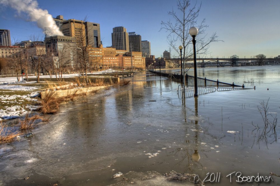
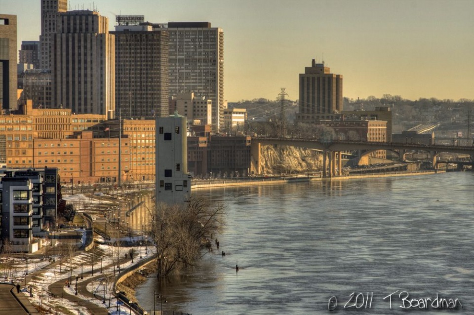
St. Paul is a river town and as one who lives by the river floods are hard to ignore. The river is both gorgeous and terrifying when it escapes it’s banks.  This years flood is going to be a record breaker and all eyes are on the River.  Sandbags were in place days ago and Warner road has been partially closed since Monday and is now completely closed.

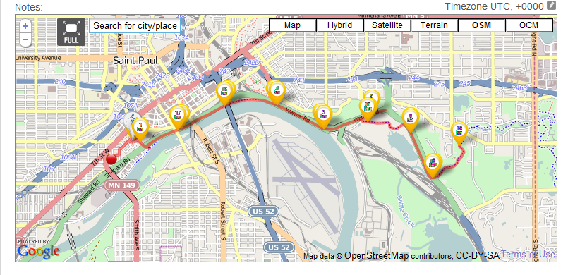
Harriet and Raspberry Island are partly under water.  The latest projections are that the river will raise to a level of 20.4 feet above flood stage by Wednesday.  20.4 feet is  two feet higher than last years flood but six feet lower than the record.  Neighborhood meetings have been held for people who live in Lowertown and on the Upper Landing it is possible that they will have to be evacuated.  [See my infographic from last week]

According to the UpDraft the below freezing weather and snow we received earlier this week prevented the water from all going into the river all at once which would have brought the water higher.  According to me we are in the season I call second Winter and I mostly hate it. 

This weekend there will be plenty of people coming down to the river to see the water. For those who do not like traffic jams or freezing cold weather there is a live cam that shows the river. The action is slow but it is entertaining. 

325 3
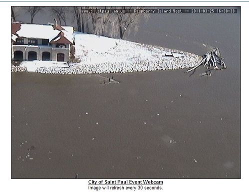
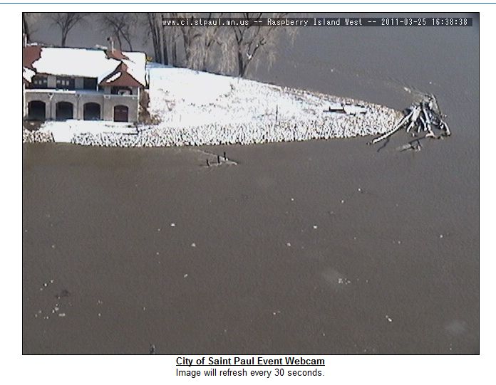
Screen shot from live cam Western end of Raspberry Island
325end
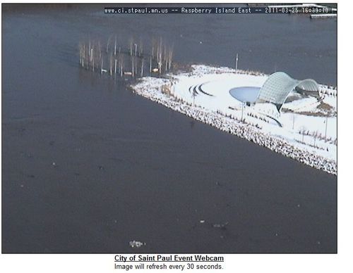
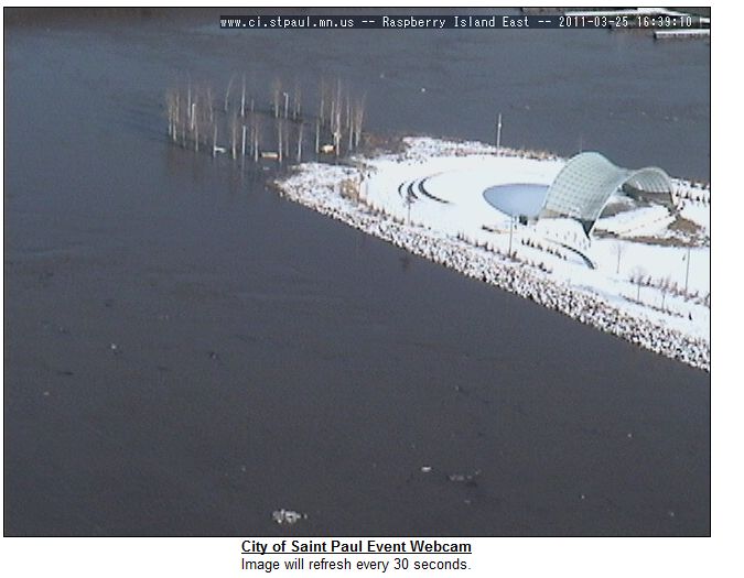
Screen shot East end of Raspberry Island
har325 2
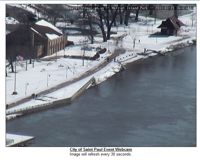
Screen Shot, Harriet Island

The steps on Harriet Island are already underwater.  I took the screen shots shortly after the river officially reached flood stage on Friday.  Later today I am going down to the river with a friend to take some pictures of reporters standing in the water, those pictures are always a crowd pleaser.